How to Read a Weather Forecast Before a UK Hill Walk
You have checked the forecast. It says 25 mph winds, cloud base 600 metres and a 40 per cent chance of rain. Is that a good day on the hills or a grim one? The numbers only help if you know what they mean once you are standing on a ridge, and on a UK hill walk the difference between a grand day out and a long, cold retreat usually comes down to three or four of them.
Start with a forecast written for the hills
The Met Office publishes mountain area forecasts for the main upland regions of the UK, and the Mountain Weather Information Service covers the same ground in a different style. Both work at summit level, which is what you actually experience — wind, temperature, cloud base, visibility, freezing level and the likelihood of rain. A town forecast for the nearest village tells you almost nothing useful about a 900-metre ridge ten miles away.
Look ahead, but be honest about the limits of what you are reading. Anything beyond three or four days is a rough sketch, and even a 24-hour forecast can shift. Re-check the evening before you pack, then again in the morning before you drive. If the two readings disagree, trust the newer one and plan for the worse of the two.
Wind is usually the deciding factor
Rain makes you wet. Wind makes you slow, cold and unstable, and it decides whether you can hold a conversation, eat a sandwich or keep a map open on a plateau. Here is roughly what wind speed feels like on open ground:
- Up to 15 mph: barely noticeable, though you will feel it on an exposed top.
- 15 to 25 mph: a steady push. A hat is worth having, and a loose map or jacket flap will annoy you.
- 25 to 35 mph: hard work on ridges and plateaux. Pace drops, balance starts to matter on boulder fields, and a bothy bag becomes difficult to manage.
- 35 to 45 mph: difficult. You lean into the wind, gates and stiles turn into wrestling matches, and a stumble can become a fall.
- 50 mph and above: for most walkers, this is a stay-low day. Save the ridge for another weekend.
Gusts matter more than the average. "30 mph, gusting 55" describes two quite different days depending on where you are. A sheltered valley path may feel calm while the col above it is a wind tunnel, and gusty conditions are exactly when people get knocked off balance on a narrow section.
Direction counts too. A south-westerly headwind on the outward leg becomes a cheerful tailwind on the way home — right up to the point where it is pushing you towards an edge rather than along a path.
Cloud base, visibility and the view you were promised
Cloud base is the height of the lowest cloud over the ground. If the forecast gives 600 metres and your summit sits at 900, you will spend the top third of the day in cloud: no view, damp clothing and navigation by compass rather than by eye.
Some forecasts quote a percentage of cloud-free summits for the day. Read that as a probability across a whole region, not a promise for your hill. It is also worth checking the visibility figure. Ten to twenty kilometres is generous. Below a kilometre, you need to be navigating properly. Below about 200 metres, enjoy the exercise and forget the photography.
Temperature, wind chill and rain
Hill air is colder than valley air. A commonly used rule of thumb is roughly one degree of cooling for every 100 metres of ascent, and it can be more in unsettled conditions. Take a valley temperature of 12°C, add 900 metres of climbing and you are looking at single figures on the top before wind is considered.
Then add the wind. A temperature of 5°C with a 40 mph wind feels dramatically colder than 5°C in a sheltered car park, which is why the "feels like" or wind chill figure on a mountain forecast is more useful to you than the plain air temperature. Pack for that number, not the one on your phone's home screen.
On rain, look at probability, amount and timing together. A 60 per cent chance of rain in a three-hour block tells you something quite different from a 60 per cent chance over twelve hours. Check whether the forecast is describing a brief shower or a band of rain that settles in for the afternoon. In winter, watch the freezing level as well: it tells you how high the snow line is likely to sit, and whether the wet rock you are expecting will actually be ice.
Read the sequence, not just the summary
Forecasts are not averages, they are sequences, and many hill days contain a perfectly good window inside an otherwise poor day. Open the three-hourly or hourly view and ask a few specific questions:
- When does the wind ease, and when does it pick up?
- When does the rain arrive, and when does it clear?
- Is the cloud lifting or lowering through the day?
- Is the temperature rising or falling?
A wind swinging from south-west to north-west with a drop in temperature usually means a cold front has passed through: often a sharp burst of rain, followed by clearer, colder and gustier air. That can be a great afternoon — or a signal to be off the tops before it arrives.
Turning the numbers into a decision
A forecast on its own does not decide anything. You do, and you do it better if you have already decided what matters.
- Name the objective. A summit, a ridge, a circuit, or simply a few hours out with a flask.
- Set your limits in advance. For example: no ridge if gusts are forecast above 40 mph, or no high ground if the cloud base is below 700 metres.
- Have a lower alternative. A wooded valley, a reservoir circuit or a smaller hill can be a genuinely good day rather than a consolation prize.
- Note the changeover time. If the rain is due at two, plan to be descending by then, not starting the final climb.
- Fix a turnaround time. Write it down. Weather decisions get harder when you are tired and 200 metres from a summit.
The morning-of check before you leave
Before you load the car, look at the live picture as well as the written forecast. Rain radar, hill webcams and a glance at the nearest hills from a window will tell you whether the cloud is sitting low or lifting. Read the mountain forecast one more time, and check the mountain safety guidance if conditions look marginal or wintry.
At the car park, take thirty seconds to write your turnaround time on a piece of paper or your phone, and look at the sky you can actually see rather than the one you read about last night. Then go, and enjoy it. A forecast is a tool for making a sensible decision, not a permission slip. The best hill plans are the ones you can enjoy in the weather you get, rather than the weather you were hoping for.
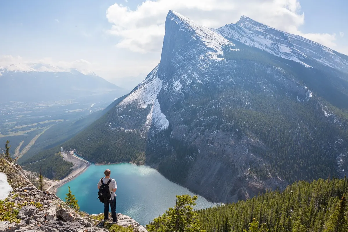
Photo: Pexels / Pixabay
You Might Also Like
A practical guide to planning a first three-day Lake District hike, covering route choice, realistic daily distances, beds, resupply and what to do when plans change.
Gas, liquid fuel and alcohol stoves each shine in different conditions. We compare weight, fuel availability, cold-weather performance and cost for British camping trips.